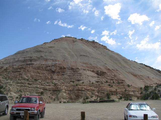
Koderma is the Mica capital of India. Koderma and Tilaiya (also known as Jhumri Tilaiya) are only two important towns in the district. Koderma is district town of Jharkhand and is well known for rich mica deposits and is also called as "Abharkh Nagari". It is essentially an under-developed, thinly populated district having varied but limited endowment of natural resources. The district is bounded by 24015'46'' and 240 49'18'' N latitude and 85026'01''and 85054'16'' east longitude and covers an area of about 1500.00 Sq Km. General Administrative Divisions Koderma district has one Sub-division, Kodarma itself and 5 (five) revenue circles. For developmental administration the district is divided into 5 (Five) developmental blocks namely: Koderma, Jainagar, Chandwara, Markachho and Satgawan. There are 717 (Seven Hundred Seventeen) Villages and 80 (Eighty) Panchayats. Physiography Koderma district lies in the Chhotanagpur Plateau at 397m above the sea level. The area exhibits undulating topography comprising hills, hillocks, plains and mounds. Northern part of the district is occupied by Koderma Reserve Forest. The highest peak is Debour Ghati (677 metre) which is the state boundary of Jharkhand & Bihar. Barakar River flows from West to East in the southern part of the district of Koderma and supports Tilaiya Hydel project, a multi purpose dam construction on it. River flows from West to East Poanchkhara, Keso, Akto, Gurio, Gukhana Nadi are the main tributaries of thr Barakar river. Sakri river is the main river in the northern part of the district which flows from south & east to north west. Ghggnna, Chhotanari are the tributaries of Sakri river. Mahua, Banyan, Sakhua, Palas, Pipal, Neem, Khajoor, Bamboo are the flora of the area and Cow, Bull, Buffalo and Goat are fauna. Though Leopard, Bear, Pig, Hiran and Hares are found in the forest area of Koderma Reserve forest. Climate The climate of Koderma can be described as a transition between the dry and moderately extreme climate of the northern India and the warm, humid climate of Bengal Basin. The climatic year of Koderma district can be divided into four principal seasons. The average rainfall in the district is 1090mm yearly Forests About 41% part of the Koderma district is covered with forests. The total forest area of Koderma district is 53,841.37 hectare. The per capita forest area in hectare is 0.14. The Koderma forest is rich in Khair, Sakhuwa, Semal, Gamhar, etc. The area of reserved forest in Koderma forest division is 639.68 Sq Km. Presently the reserved forest area of Koderma district is declared as wild life sanctuary. Minerals Koderma district is rich in minerals. The Koderma district and the Lokai-Indarwa area cover the southern part of Great Mica-Belt of Jharkhand. Once upon a time Koderma district was famous for its mica production worldwide and the district is known as "Mica City". But gradually excavation of low quality of mica ore and high cost of production results in closure of mica related industry. The rock type exposed in the region consist of a series of meta sediments like Mica-schist, quartz-schist, Micaceous-quartz-schist, hornblende schist and para amphibolite. The group of gneissic rocks consists of granite-gnesis, biotite-gnesis of chotanagpur granite gnessic complex which are younger to meta sediments in age and are also occuring in association with the above rocks. The Mica schist is interbeeded with a bands of hornblende schist, talc schist, granulite and gnesis, Micaceous quartzite, several granitic bodies intrude all these rocks. Observed nferendetola area close to Dwajadharipahari of Koderma showing colourful granite very much similar to Jhansi granite. The area have been investigated during field season 2002-2003 and this granite gets good polished which may be a very good marketable decorative and ornamental granite rocks.  The coarsed granite rocks are showing chilled contact effect with the adjoining gneisses rocks and shows a faint foliation near the contact. On the other hand the granite & schist are traversed by the dykes, quartz veins and pegmatities. The pegmatite penetrates the schistose & gneissose rocks used as a tools of Mica search on surface. mostly the Mica books are occurring in the pegmatities. The majority of the pegmatite originate through the digestion & re-crystalisation of mica schist. The pegmatite generally consist of plagioclase feldspar, quartz but in few cases it also contain garnet, tourmaline, and beryl. In Mica belt the granitic rocks constitute about 33% of the total area, some are Dome-shaped and lie in the surrounding area of the belt. Where as the metamorphic rocks constitute about 67% of total Mica belt. Structure The Mica belt consists of Igneous and Metamorphic rocks. The are is structurally disturbed with antiform and synform with a number of cross folods dissecting the rocks. The main structural trends in the mica belt are controlled by the folding in the meta-sedimentary rocks of the area. Generally the fold axis strikes ESE to WNW but at some places it changes from NNE to SSW. The lineation due to elongation of minerals is commonly found in the granite genesis and mica schist, with a dip varies from 30 to 40 towards ENE. The foliation of the schistose rock strikes about ENE to WSW with a dip varies from 30 to 60 in northerly or southerly direction depnding upon the folded nature of the schist. Many numerous slip planes traverse the schistose rocks which are parallel to sub-parallel to the axis of fold causing foliation in the schist. Some small fault marked in the area by silcification, brecciation. In the area three to five sets joints are also noted in the intrusive granite. Mineral Occurances in Pegmatites The Koderma area is known for the GMB where the most of the mineral are deposited in the pegmatite veins which are controlled either by lithology or by structure. In major cases the pegmatities are generally confined to Mica schist due to its easy penetrable tendency, it appears to be more amenable to development of structural locales. the inclusion and recrystallisation bands of Mica schist helps to develop pegmatite. It is also noted that the Mica shoots are within the hanging wall and footwall zones at the contact of quartz core. The localization of pegmatities and Mica shoots in pegmatite is largely controlled by structure. The bedding & foliation of the country rock guides the pegmatite veins, and strike of bedding and foliation planes in country rock help for pinch and swell to the pegmatite bodies. It is reported that the Mica bearing pegmatite found on the nose & limb of the fold e.g. located in the Bandarchua Mica mines. It also found in slip or fracture planes, showing wavy contact with schist observed in Khalaktambi mines west of the Bandarchua mines, located in the densely forest area of Koderma. It has been observed that the grain size of phegmatite decrease towards the boarder and increases in the center where the Mica books are located more commonly towards the side of the vein than in the center. The Mica pegmatites veins ranges from a fraction of centimeter to over 10 metres quartz veins are invariably noted as a core in the thicker pegmatite veins. Felspar of different varieties are also associated with the pegmatites. Feldspar and Mica are seen arranged on either side of the quartz core.So, pegmatite is generally consists of plagioclase feldspar and quartz but they also contains microcline,biotite, tourmaline, garnet, apatite and beryl. Minerals of Koderma Areagmatites (I) Mica is important strategic mineral and due to its excellent insulating properties and high heat-resistance capacity it is used in the electricity industries. It is used in paint industries as well as in the medicine. The world famous quality Ruby Mica produced in India out of which the maximum production of Mica comes from Koderma Mica belt. The Mica belt covers the maximum area of Koderma district but the productive zone covers an area of 12 sq. km lies in the Koderma Reserve forest. The Mica belt is fringed along the northern margin of Chhotanagpur plateau. It is an integrated part of precambrian, Satpura / Singhbhum orogeny and extends roughly ENE-WSW. The Koderma Mica belt was universally acknowledged as the world largest producer of ruby Mica which are hosted within the grantic pegmatities specific of high grade metamorphic terrain. Some important Mica mines in an around Koderma are Bandarchua, Suggi, Pesra-Uparchala, Khalaktambi, Dhab, Dhanapahari, Guthwa, Domchach, Kushana, Dashro, Dumerdiha, Katiya, Arwatanr and Jalahia etc. TOURISTS SPOTS - Tilaiya Dam It is the first Dam and hydro -Electric power station constructed by Damodar Valley Corporation across Barakar River, in Koderma district. The dam is 1200 ft long and 99 ft high situated in an ideal surrounding with a beautiful reservoir in 36 sq km area. Built with the main object of controlling floods, the hydro -electric station produces 4MW. The beautiful natural surroundings are the attraction to tourists. The main road from Barhi on G.T.road through reservoir and the hillocks is picturesque PRIME SITES – - Hydro-Electric Power House.
- Terrace Gardens on the hillock Deer Park.
- Picnic Island with swimming corner approachable by motor boats.
Makamaro Hills The Makamaro hill near Dhab also has some religious relevance. It is believed that Parsuram had killed his mother and three brothers here on instruction of his father. Shaktipeeth Maa Chanchala Devi Situated in the Koderma-Giridih highway around 33 kms from the district headquarters. Maa chanchala devi temple is situated about 400 ft above the hilland is one of the form of goddess Durga. Nearby hill there is a big cave having rock paintings of four forms of goddess Durga. Entering into the cave is difficult as the passage is very narrow. A large number of devotees reached here on Tuesday and Saturday in a week. The use of Sindur (vermillion) is prohibited. A large number of marriages are solemnized here. How to reach Koderma – Air: The nearest airport is at Ranchi. Rail: Nearest railway station is Koderma on Grand Chord line of the Eastern Railway. The distance from koderma Railway Station is 19 Kms. All sorts of vehicles ply between Koderma and Hazaribagh through Tilaya Dam Road: It falls on Patna - Ranchi Road. It is 17 kms. from Barhi and 47 kms. from Hazaribag. Where to Stay - D.V.C Rest House, Tourist Bungalow run by D.V.C Urwan Tourist Complex Few kilometres from the Tilaiya dam is Jharkhand State tourism Development's Tourist Complex at 'Urwan', where one can consider spending time by the side of the dam, where one can enjoy boating and other water sports. Interested tourists can follow the main road and drive to Hari Har Dham at Bagodar which is famous for the 52 feet high Shiv Ling which took 30 years to complete and is believed to be the tallest in the world. |